Flooding
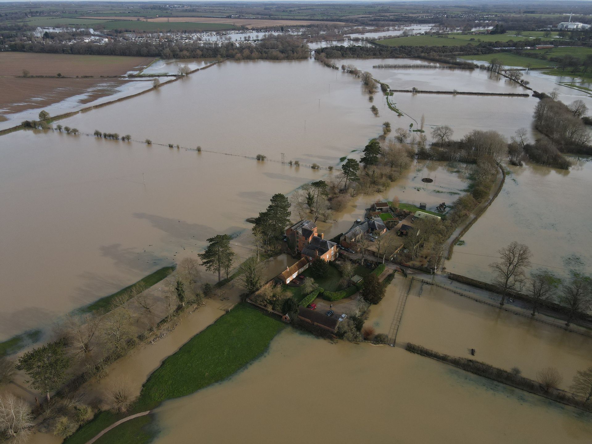
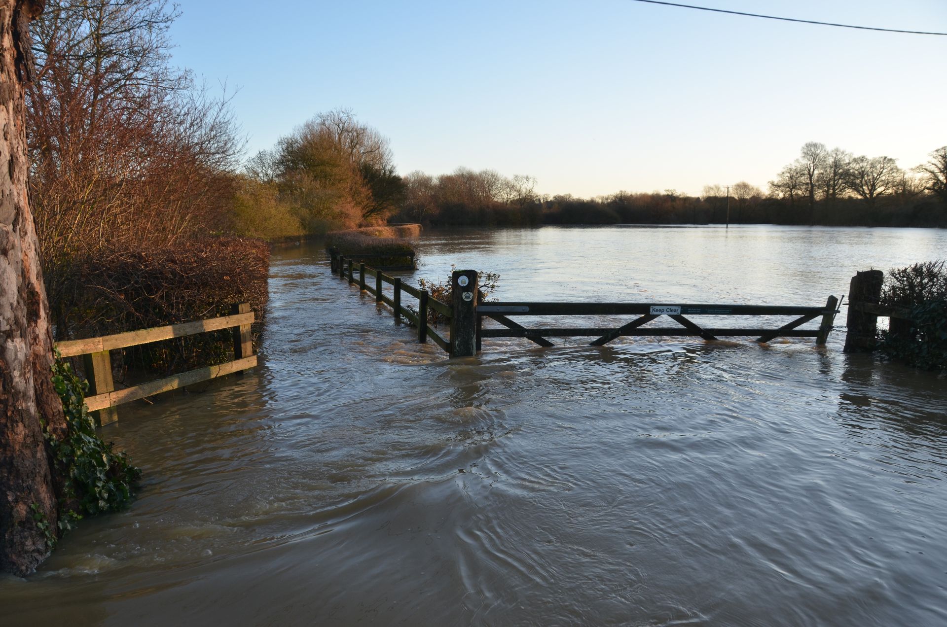
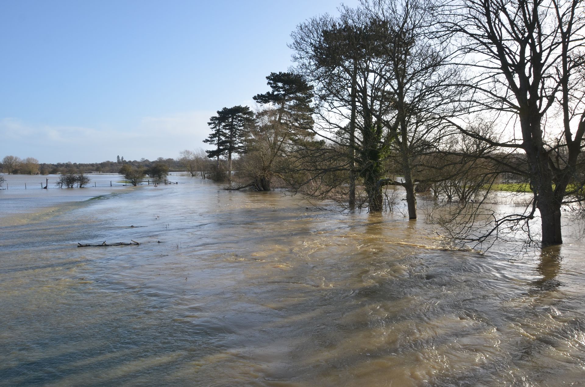
Immediately below the development the Great Ouse floodplain has regularly flooded on average at least once a year. With climate change, this is now occurring several times a year and predicted to worsen, leading to increased flooding in Stony Stratford as well as Newport Pagnell, downstream of the site. The site itself is prone to flooding as can be seen from our recent images, as it lies within the Dogsmouth Brook flood zone. The image below shows the flood-zone across the site (with the site outlined in red).
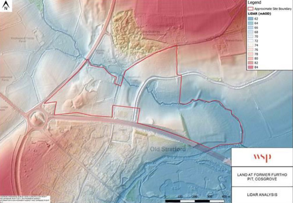
Flood-zone crossing proposed site (site outlined in red)
Button
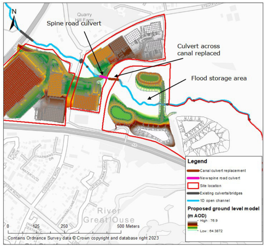
The developer wants to increase the size of this little culvert at the Buckingham Arm (shown above). The Environment Agency say the culvert cannot be scaled up – it holds back water from escaping too fast into the River Great Ouse. If it is increased in size that would exacerbate the flooding in Stony Stratford and downstream in Newport Pagnell.
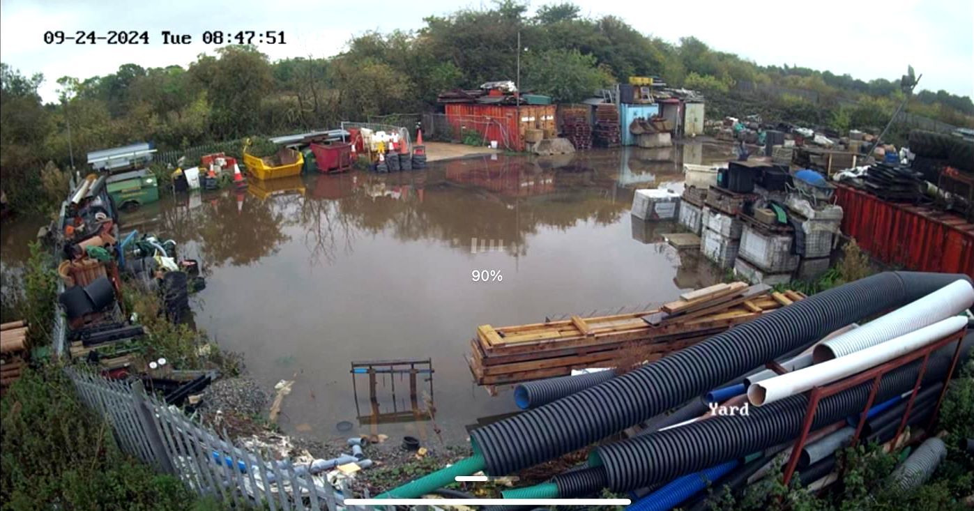
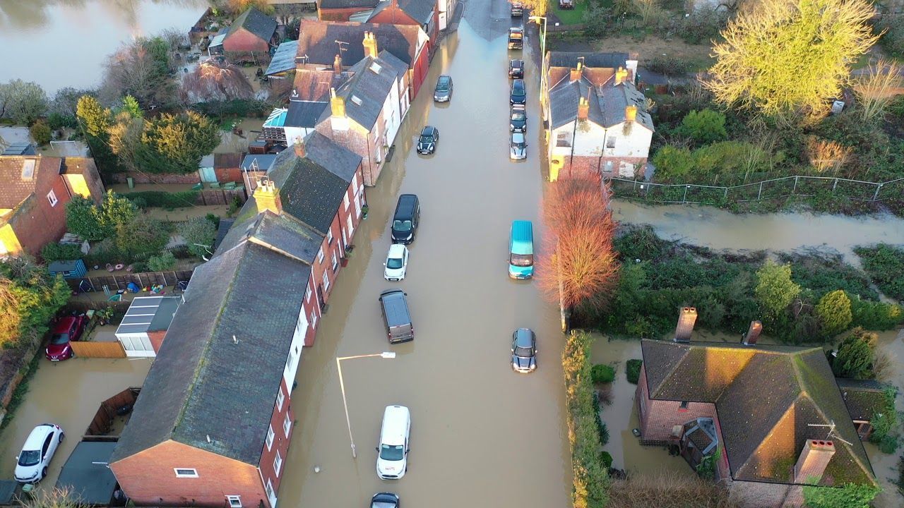
This image shows flooding in the centre of the built site, September 2024
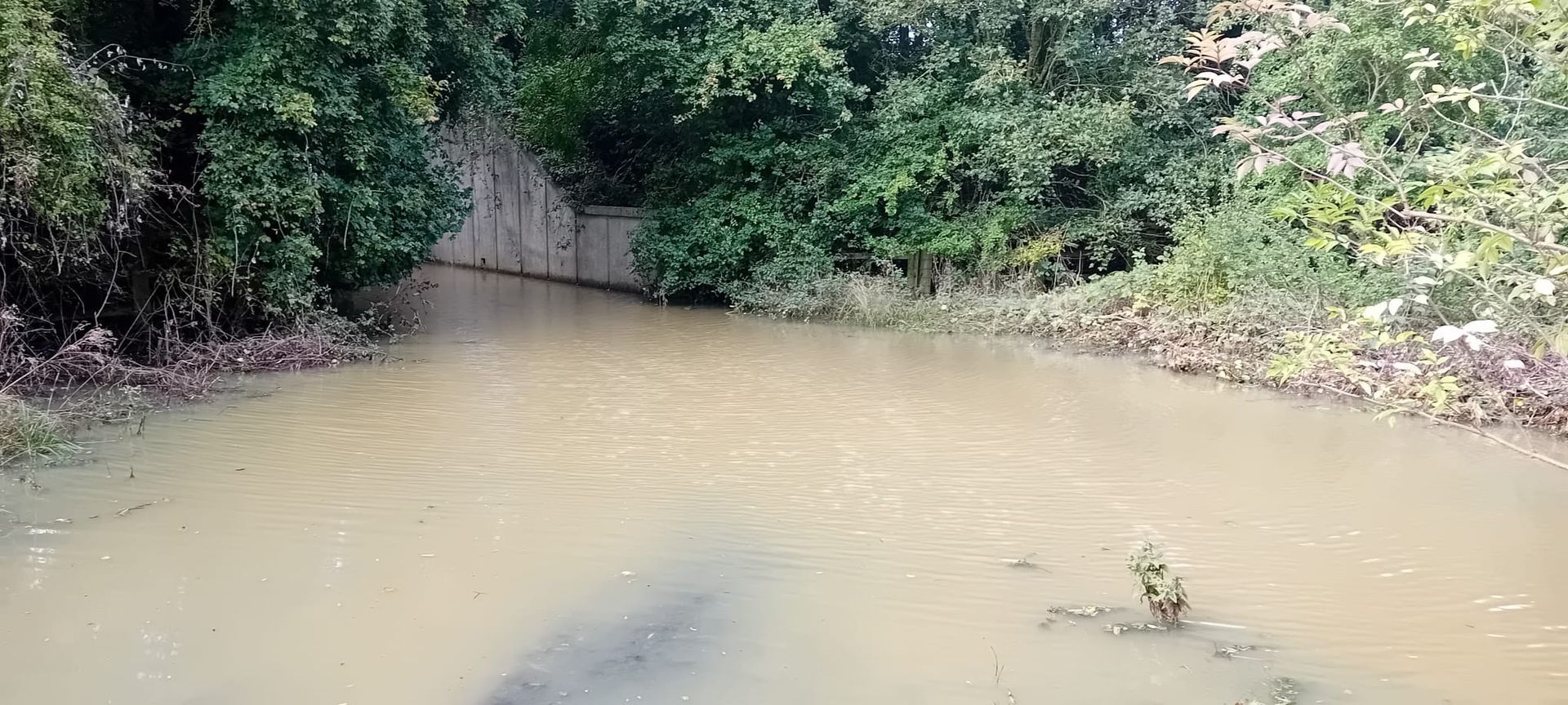
The unpassable underpass in the corner of the built site
“...the site may be at risk of great depths of flooding with vehicles being potentially lifted in deep flood water. The northern site could potentially be cut off if flood water submerges the Spine Road with Old Cosgrove Road and Stratford Road already submerged..”
The Environment Agency
The Environment Agency (EA) initially - and over a period of two years - objected to the developer’s first four proposals, citing concerns over lost soakaway due to extensive tarmac and concrete. Despite claiming at the outset that the site does not flood, the developers have now submitted a fifth flood mitigation plan for 2025, which attempts to revert to an earlier approach that enlarges the canal culvert to accelerate drainage. The previous proposal (August 2023) involved a Flood Storage Area (FSA) storing 44,000m³ of water (about 20 Olympic-sized pools) in attenuation lakes and an earth dam. We pointed out that this scheme constituted a high-risk reservoir and the EA agreed. This is a major engineering project, and its size will require stringent regulation including a supervising engineer to monitor it during construction and every year after that.
We - along with both Old Stratford Parish Council and Cosgrove Parish Council - have commissioned several hydrology reviews by an independent consultant to assess each submission of planning documents. Their latest report still concludes: “The Flood Response Plan lacks key information, inaccurately assesses flood risks, and should be rejected by the EA and LLFA.” A full copy of all these reviews is available here.
In June 2025, the EA unexpectedly withdrew its objection but imposed stringent conditions. The EA rejected the developers preferred minimal mitigation plan in favour of the Flood Storage Area (FSA) to manage site and downstream flood risks. However, the EA does not consider the plan to be sustainable and has urged the Local Planning Authority to carefully review its viability.
In their letter, they stated that they ‘do not find this proposal to be a sustainable development as it introduces a residual risk to the catchment downstream. We recommend to the Local Planning Authority (LPA) that they should carefully consider the overall sustainability of the principle of the Flood Storage Area (FSA). Although this mitigates the flood risk to the site resulting from the development, it is introducing an additional engineered residual risk’. Despite ongoing concerns, developers have not fully explored safer alternatives, such as relocating the project.
The Lead Local Flood Authority (LLFA) also deemed the developers’ submission inadequate. In their letter dated May 2025, they state that ‘We do not consider that sufficient evidence has been provided to demonstrate that the proposed development is a sustainable solution with respect to management of flood risk within and downstream of the site’.
Additionally, the EA still has major concerns about site contamination, requiring assessment and remediation to prevent water pollution, and have also imposed stringent conditions relating to this aspect. Failure to meet these conditions would lead to a renewed objection, as the development could pose an unacceptable environmental risk.
Crucially, the EA’s withdrawal of its objection does not mean the development is safe; it simply means that conditions have been set and must be scrutinised carefully. We questioned the EA as to why their previous objection was withdrawn despite ongoing concerns regarding increased flooding downstream and they clarified that ‘some of the conditions require information to be submitted prior to the commencement of the development and so the development should not go ahead until this information has been received and approved.’
We must continue to demand accountability and transparency to ensure local flood safety is
not compromised.
Large, raised reservoirs may be classed as high-risk when human life would be endangered if the dam fails, causing an uncontrolled release of water. If this dam fails it would cause a potential loss of life as well as calamitous flooding upstream in Stony and downstream in Newport Pagnell.
“We note the compensatory Flood Storage Area (FSA) is proposed to hold a large volume of flood water and that it will fall under the ambit of the Reservoirs Act 1975.....and it will be most likely considered a ‘high’ risk reservoir due to its location.”
The Environment Agency
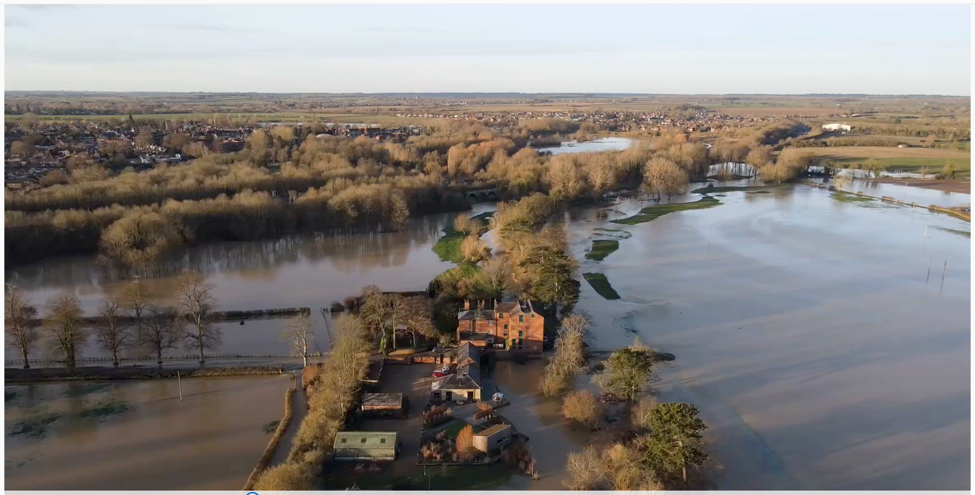
Ouse Valley flooded, downsteam from site with site behind, 2021
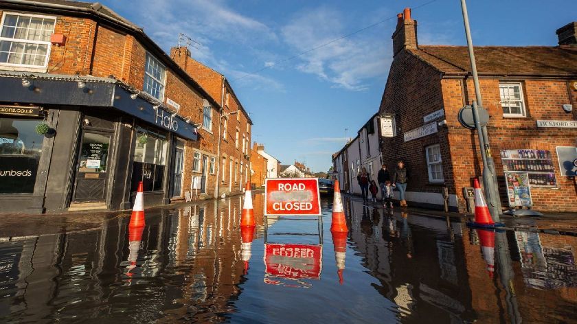
Stony Stratford High Street flooded, Dec 2020
Stony Stratford High Street flooded, Dec 2020

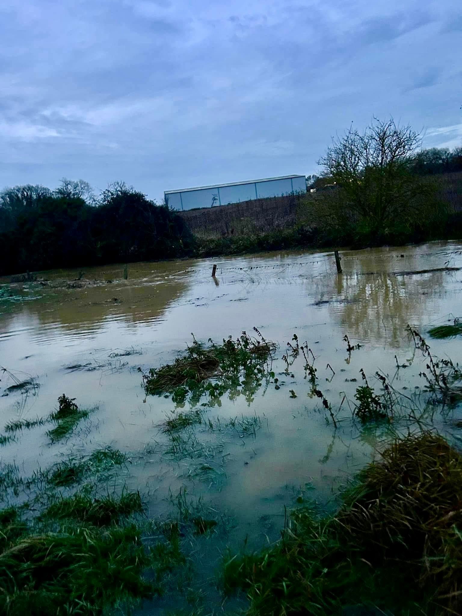
The Dogsmouth Brook flooding Stratford Road, Cosgrove, 1970's


“ We do not find this proposal to be a sustainable development as it introduces a residual risk to the catchment downstream. We recommend to the Local Planning Authority (LPA) that they should carefully consider the overall sustainability of the principle of the Flood Storage Area (FSA).Although this mitigates the flood risk to the site resulting from the development, it is introducing an additional engineered residual risk.”
The Environment Agency, May 2025
- Major loss of soakaway in a WNC Flood Zone, leading to the risk of increased flooding in Stony Stratford and downstream in Newport Pagnell
- Developers propose enlarging the culvert under the canal, disregarding the Environment Agency’s warning that this would worsen flooding risks by accelerating water flow to the Ouse
- The developer's plan to create a massive reservoir is a major engineering project and was not part of the original scheme. If it breaches, it could cause extensive flooding and potential loss of life.
- The reservoir will be filled with effluent-rich water during periods of high rainfall. Logic dictates that if the outflow is slower than the inflow, the reservoir will fill up. In that case, where will the floodwater go?
- Any flood storage scheme will function as a reservoir, requiring ongoing regulation and maintenance by site owners. The ‘reservoir’ will still be an earth bund with “engineering fill.”
- Developers boldly claim the development will “reduce” flood likelihood. The EA still have concerns about this as do the LLFA who don’t believe it is a sustainable solution with respect to management of flood risk within and downstream of the site.
